DRONE I GEOSPATIAL WORLDPVT LTD
Flying to Mapping
Precision MappingFrom Sky to Ground
Transform your projects with cutting-edge drone surveys, LiDAR mapping, and geospatial intelligence. Solution-based services tailored to your unique requirements.
Comprehensive Geospatial Solutions
From aerial surveys to digital twin creation, we provide end-to-end mapping solutions that transform how you visualize and manage your projects.
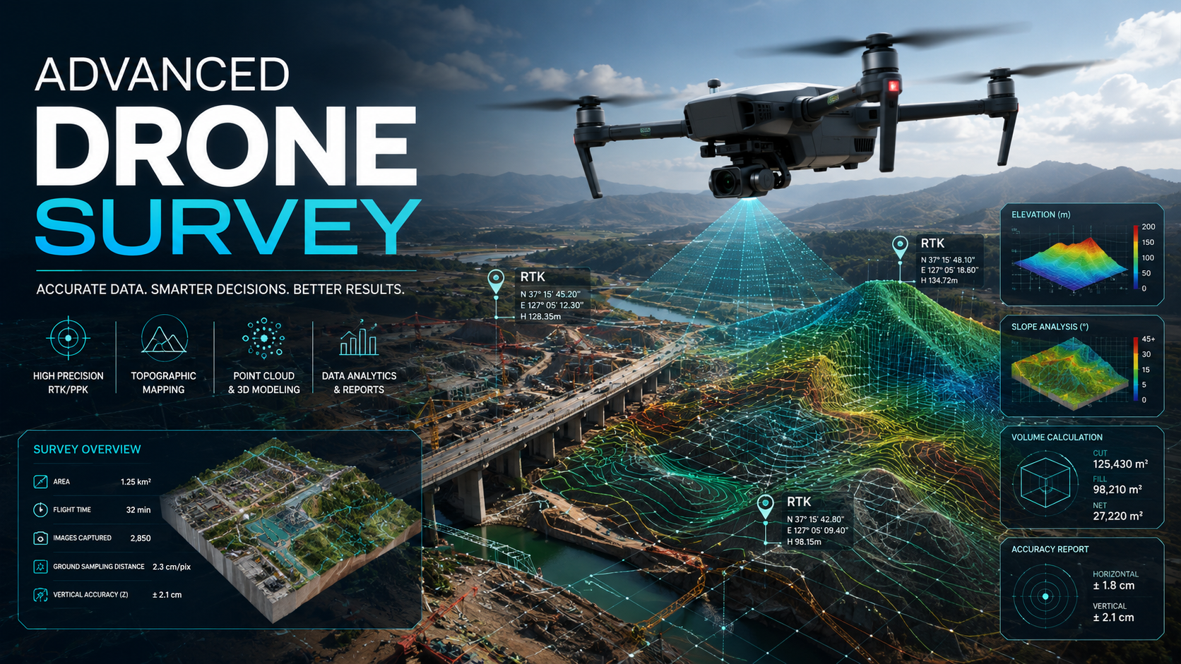
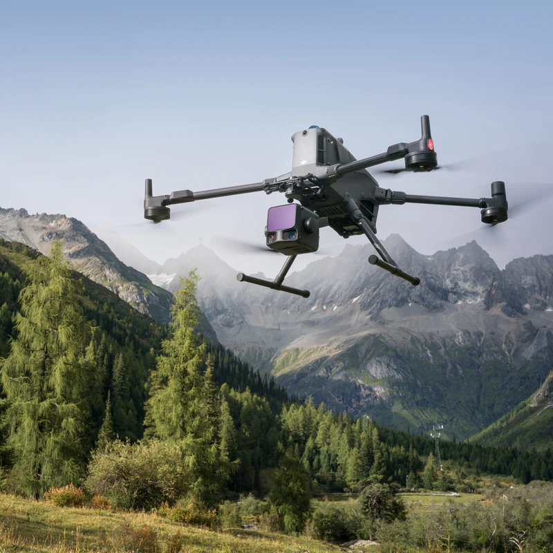
Advanced Drone Survey
High-precision aerial surveys using state-of-the-art drones for topographic mapping and volumetric analysis.
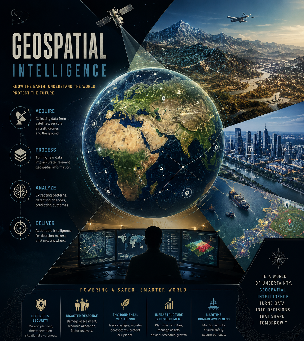
Geospatial Intelligence
Transform raw data into actionable insights with our GIS expertise and spatial analysis capabilities.
LiDAR Survey & Mapping
Advanced Zenmuse L2 LiDAR technology for precise 3D point cloud data and terrain modeling.
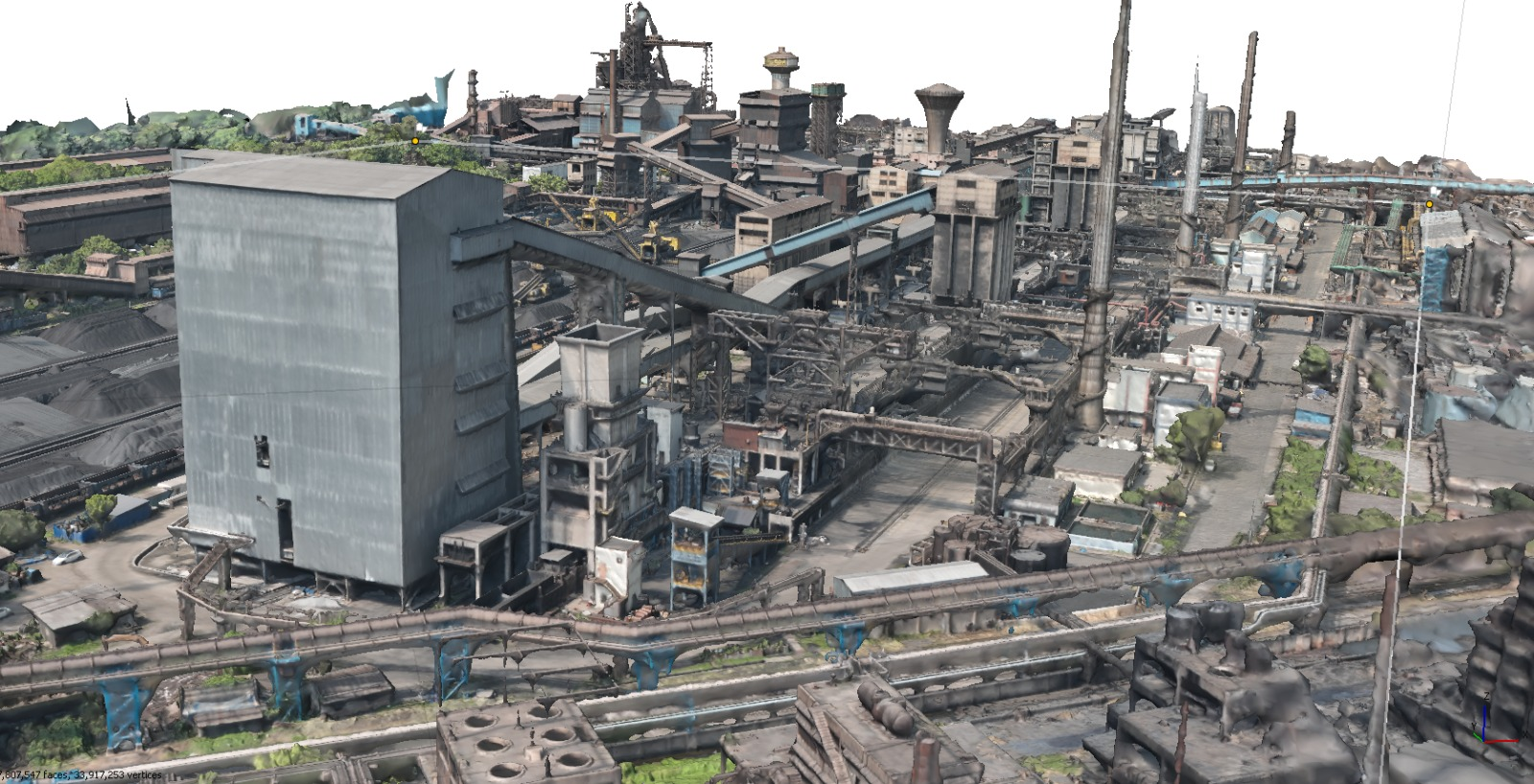
Digital Twin Models
Create accurate digital replicas of physical assets for monitoring and predictive maintenance.

DGPS Solutions
Centimeter-level positioning accuracy with Differential GPS for construction and surveying.

Custom Project Design
Tailored solutions designed to meet your specific project requirements from concept to delivery.
One Geographer's Passion Turned into Industry Excellence
Founded in April 2024 by Rayudu, Drone-i-Geospatial World brings together 18 years of expertise in Digital Photogrammetry, GIS, and Remote Sensing. What started as a passion for geography has evolved into a comprehensive solution-based mapping company.
Our founder holds a Master's degree in Geography with GIS & Remote Sensing specialization and is currently pursuing a PhD in Remote Sensing & GIS Technology. This academic rigor, combined with hands-on industry experience, ensures every project meets the highest standards.
Project Gallery
Explore our portfolio of drone surveys, aerial mapping, and geospatial projects delivered across various industries and terrains.
Agricultural Land Mapping
Comprehensive aerial survey of agricultural land with crop pattern analysis and infrastructure mapping.
Trusted by Industry Leaders
Our commitment to precision and customer satisfaction has earned us the trust of organizations across diverse sectors.
“Drone-i-Geospatial provided exceptional LiDAR mapping services for our infrastructure project. The precision and attention to detail exceeded our expectations.”
“Their expertise in GIS and drone surveys transformed how we manage our land resources. Highly professional team with cutting-edge technology.”
“The digital twin models created for our facility have been invaluable for maintenance planning. Outstanding quality and technical support.”
Certified & Affiliated With
Download OurServices Brochure
Get a comprehensive overview of our geospatial solutions, drone mapping capabilities, and how we can transform your projects with precision mapping technology.
Free download - No email required
Services Brochure
Drone-i-Geospatial World
What's Inside
Ready to Transform Your Project?
Get a free consultation and discover how our geospatial solutions can bring precision and efficiency to your mapping needs.