QUALITY IS OUR FIRST CONFIDENCE - CLIENT IS OUR PRIMARY CONCERN With Special Offers We are an experienced DRONE SURVEY COMPANY
See How It Works

Home

drone

Welcome to Drone I Geospatial World

About Company

Drone survey and mapping have revolutionized the way we develop maps data, offering unparalleled efficiency, ease of understanding, and perfect accuracy. This advanced technology is 100% reliable and provides a cost-effective solution for businesses aiming to make clear-cut decisions about significant assets.

Efficiency and Accuracy

Drones equipped with high-resolution cameras and advanced sensors can capture detailed aerial imagery and geospatial data. The precision and speed at which drones can survey large areas significantly reduce the time and labor costs associated with traditional surveying methods. This efficiency allows for more frequent updates, ensuring that the maps data is always current and accurate.

Happy Living Start Here

Our Quality, Vision & Mission

Our Quality:
At Drone I Geospatial World, our commitment to quality is the cornerstone of everything we do. We utilize the latest in drone technology and geospatial analysis to deliver precise, reliable, and accurate mapping solutions. Our meticulous attention to detail ensures that our clients receive data that is not only current and comprehensive but also easy to understand and actionable. We pride ourselves on our ability to provide cost-effective and efficient services that empower businesses to make informed decisions with confidence.

Vision:
To be the leading provider of innovative drone survey and mapping solutions, transforming the way businesses manage and optimize their significant assets through superior accuracy, reliability, and clarity.

Our Mission:
To deliver top-quality geospatial data through cutting-edge drone technology, enabling businesses to make precise, clear-cut decisions. We strive to achieve excellence in every project by focusing on efficiency, accuracy, and customer satisfaction, thereby driving success and growth for our clients.

Our Services

Developing the Maps data through drone survey and mapping is Efficient, easy-understand, 100% reliable and Perfect accurate. MAPS HELPS businesses to make RIGHT CLEAR CUT DECISSIONS more cost-effectively and efficiently regarding significant assets

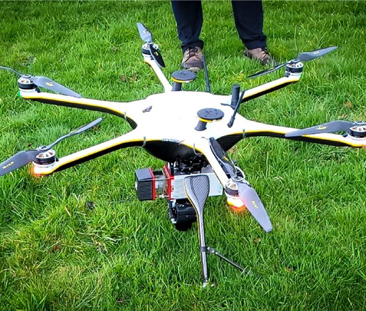
At Drone I Geospatial World, we believe that quality is the foundation of our confidence. Every drone survey we conduct is executed with the highest standards of precision and reliability. Our state-of-the-art technology and expert team ensure that the data we provide is not only accurate but also actionable and easy to understand.
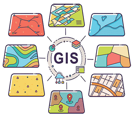
Geographic Information Systems (GIS) mapping services are revolutionizing the way we collect, analyze, and interpret spatial data. By transforming raw data into visual maps, GIS mapping services provide powerful tools for decision-making across various industries.
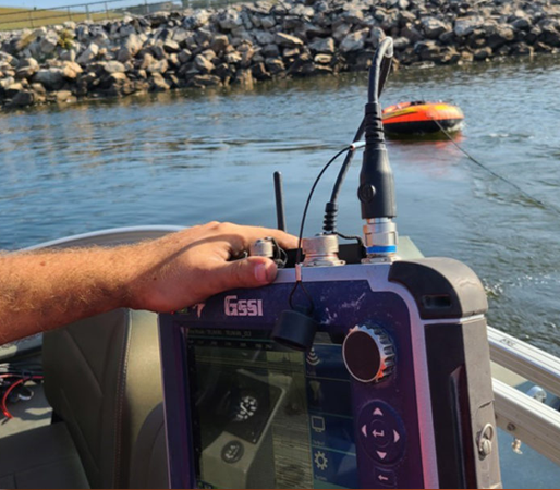
A bathymetric survey involves the measurement of underwater depths in lakes, oceans, and other significant water bodies. This scientific process uses advanced technology to create detailed maps of the underwater terrain, crucial for a variety of applications ranging from safe navigation to environmental research.

Experience

25 Years

Completed

30 Projects